How to estimate
operational spectral attenuation coefficient 2K

for remote sensing radiance in water,
so that: no need for field data for shallow water work!


This page was developped in 2016 after 22 years of experimenting.

Please first get a feeling of 4SM:
peer-reviewed article 2017
 presentation   and   summary 


see some most interesting reading
about Secchi depth and Jerlov's optical classification of marine water types:
 A New Algorithm to Estimate Diffuse Attenuation Coefficient
from Secchi Disk Depth, 2020
 

The Effect of Optical Properties on Secchi Depth
and Implications for Eutrophication Management, 2019


Influence of the vertical distribution of cyanobacteria
in the water column on the remote sensing signal
, 2008

 
Conclusion            But wait!

In order to ensure that "no need for field data":
* leave all wavelengths at mid waveband
* apply an image-specific CoefK>=0.0,
 
or use a -CP...argument.
 

As of july 2016, I have gathered growing evidence to show that
applying CoefK~=0-2  in the orange-red range
suits most Landsat 8 scenes
possibly related to diffuse atmospheric lightfield


Following Maritorena, Lyzenga, Kirk and Jerlov:get operational spectral 2K
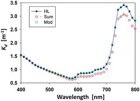
BPL assumption: in 4SM, we derive operational spectral diffuse attenuation coefficient 2K for remote sensing radiance
  • using Jerlov's table of diffuse attenuation coefficients for downwelling irradiance in water under clear sky conditions, sun high in the sky.
  • See quotations by Jerlov, and by Kirk.
Ki/Kj : for this, we estimate the ratios Ki/Kj from all visible bands i and j in the image, using a protocole slightly modified from Lyzenga.
  • Note that one must ensure that Ki/Kj =(Ki/Kk)/(Kj/Kk).
  • This turns out to be a sensitive requirement over the Yellow-Red range.
 
The ratio Kblue/Kgreen is then used to interpolate operational spectral K for all visible bands, as suggested by Kirk. Note that one needs to specify the operational spectral wavelength for all visible bands.
Mid-waveband: by default, one commonly uses the wavelength at mid-waveband, although there is room for accounting for the specific radiance response curve of each wideband.
Two-ways : we then use 2K in the simplified radiative transfer equation
So we expect that coefZ~=1   in         FinalZ=coefZ*RetrievedZ - Htide,
  • i.e. no need for field data!
  • wavelenths at mid-waveband
  • coefZ~=1
  • 2K in units of m-1
  • Z   in units of m
  • L, LB and Lw in native image DNs, as this is a "ratio" method:
    • no need to convert into units of reflectance (0-1)
Achieving a good fit in optical calibration diagrams
requires decreasing 2K in the 0-~10 m depth range,
i.e. in the Yellow-Red range
in line with Jerlov's statement
Then maybe: no need for field data!


Evidence 1: Bottom detection by OLI's red band at Caicos bank
 
Deglinted Red band
Landsat 8 OLI Caicos
(13 may 2013)

Red band at 655 nm

in this image exhibits bottom detection  in excess of 10 m,
as evidenced using BILKO's field dataset
  • This means that operational Kred for remote sensing radiance is distinctly lower in this scene than diffuse attenuation coefficient for downwelling irradiance Kdred of Jerlov.
  • Either we need to shift WLred at an operational wavelength much shorter than mid-waveband, which would only reach down to ~6 m over very bright bottoms.
    • I suppose sensor designers would object loudly!
  • Or , as I realized using HYPERION in 2014, operational  2Kred  for remote sensing radiance is affected by viewing geometrical conditions and/or atmospheric optical properties.
  • See comment by Jerlov.


Evidence 2: Optical calibration using HYPERION at Fakarava atoll
band_4=Blue, band_11=Green, band_21=Red
Bad fit Good fit

bad fit : coefK=0.0

good fit: coefK=1.0

bad fit : coefK=0.0

good fit : coefK=1.0
Spectral CoefK observed for this Fakarava HYPERION image is now hard-coded.
CoefK  may take any value >=0 as required to achieve a good fit.
This is supported by a growing number of study cases:

  HICO at Bahrain coefK=1.9 very dense atmosphere
g
 
HICO at Lee Stocking Island 
   WV2 at Princess Cays   


Evidence 3: Optical calibration using Landsat 8 OLI at Fakarava atoll 
band_2=Blue, band_3=Green, band_5=Red
see also Landsat 8 OLI at BahiaSanJuanico
Landsat 8 OLI 25 july  2014
Bad fit
Landsat 8 OLI 25 july  2014
Good fit

bad fit : coefK=0.0
Landsat 8 OLI Fakarava 25 july  2014

bad fit : coefK=1.0
Landsat 8 OLI Fakarava 25 july  2014

bad fit : coefK=0.0
Landsat 8 OLI Fakarava 25 july  2014

good fit : coefK=1.0
Landsat 8 OLI Fakarava 25 july  2014

 
Landsat 8 OLI 22 march 2015
Good Fit


good fit : coefK=1.0
Landsat 8 OLI Fakarava 22 march 2015

 
Landsat 8 OLI 22 march 2015
Good fit


good fit : coefK=1.0
Landsat 8 OLI Fakarava 22 march 2015


Evidence 4: Optical calibration using WV2 at Princess Cays
A blind WV2 test on Sept 28th 2012 
princesscaywv_5_4_3_2_cWL=0.5
Sept 28th 2012: first calibration
all wavelengths at mid-waveband
2K    0.091 0.074 0.142 0.535 0.799 3.50 4.490 8.9

[X2-3] vs [X5]: notice the bad fit
Seatruth by Digital Globe October 3rd 2012
 on Sept 28th preliminary work
using UKHO's MBES DTM
DG_Morel-Comparison Sept 28th 2012
DG's depths vs DTM         4SM's depths vs DTM

This image, compiled by Gregory Miecznik,
compares results obtained
  • LEFT:   by Gregory Miecznik DG's method
  • RIGHT: by Yann Morel           4SM method
This diagram provides 
a compelling support
to the CoefK proposition.
 
 
  • K2/K3=0.52 is appears to be fairly well established
    • this yields K2=0.074 m-1  and K3=0.142 m-1
  • CoefK=0: this entails a bad fit as evidenced by the [X2-3]vs[X5] diagram
  • Applying a CoefK>0 value would have achieved a good fit in the [X2_3] vs [X5] diagram.

 
This diagram provides
a compelling support 
to our claim that
"no need for field data".
  • 0-8 m depth range: display of 4SM depths
    • applying a CoefK>0 value would have  achieved a diagonal display of 4SM depths.
  • 8-25 m depth range: all 4SM depths are overestimated by ~3.5 m. This means that:
    • slope: K2=0.074 m-1  and K3=0.142 m-1 are correct. No need for field data!
    • offset: the slope of the Soil Line should be distinctly increased in order to get good-looking results over the MBES coverage,   as explained. This is to be done by decreasing LsM for the Green band.
This was in 2012
As of july 2016, I know better


Evidence 5: Optical calibration using HICO

HICO at Bahrain

HICO at La Parguera


Evidence 6: Optical calibration using SPOT
 
SPOT at Rangiroa
WL at mid-waveband
 
 
Conclusion

In order to ensure that "no need for field data":
  • Leave all wavelengths at mid waveband.
  • Apply a image-specific CoefK>=0 in the yellow-red range,
    • or use a -CP...argument.
 
But wait: AOPs are not additive!


"AOPs Are Not Additive:
On the Biogeo-Optical Modeling of the Diffuse Attenuation Coefficient"
by Zhongping Lee et al., 2018

Front. Mar. Sci., 30 January 2018 | https://doi.org/10.3389/fmars.2018.00008
 
  • Commonly we see the diffuse attenuation coefficient of downwelling irradiance (Kd) expressed as a sum of the contributions of various constituents.
  • We show here that, both theoretically and numerically, because Kd is an apparent optical property (AOP), this approach is not consistent with radiative transfer.
  • We further advocate the application of models of Kd developed in past decades that are not only consistent with radiative transfer but also provide more accurate estimates, in particular for coastal turbid waters.


Créer un site
Créer un site